PS Extraordinary Tales
 Dreamer
I have been constructing a sort of alternate world gothic wild west setting vis-a-vis an ongoing project, originally a novel, now a comic I am collaborating on with an artist.
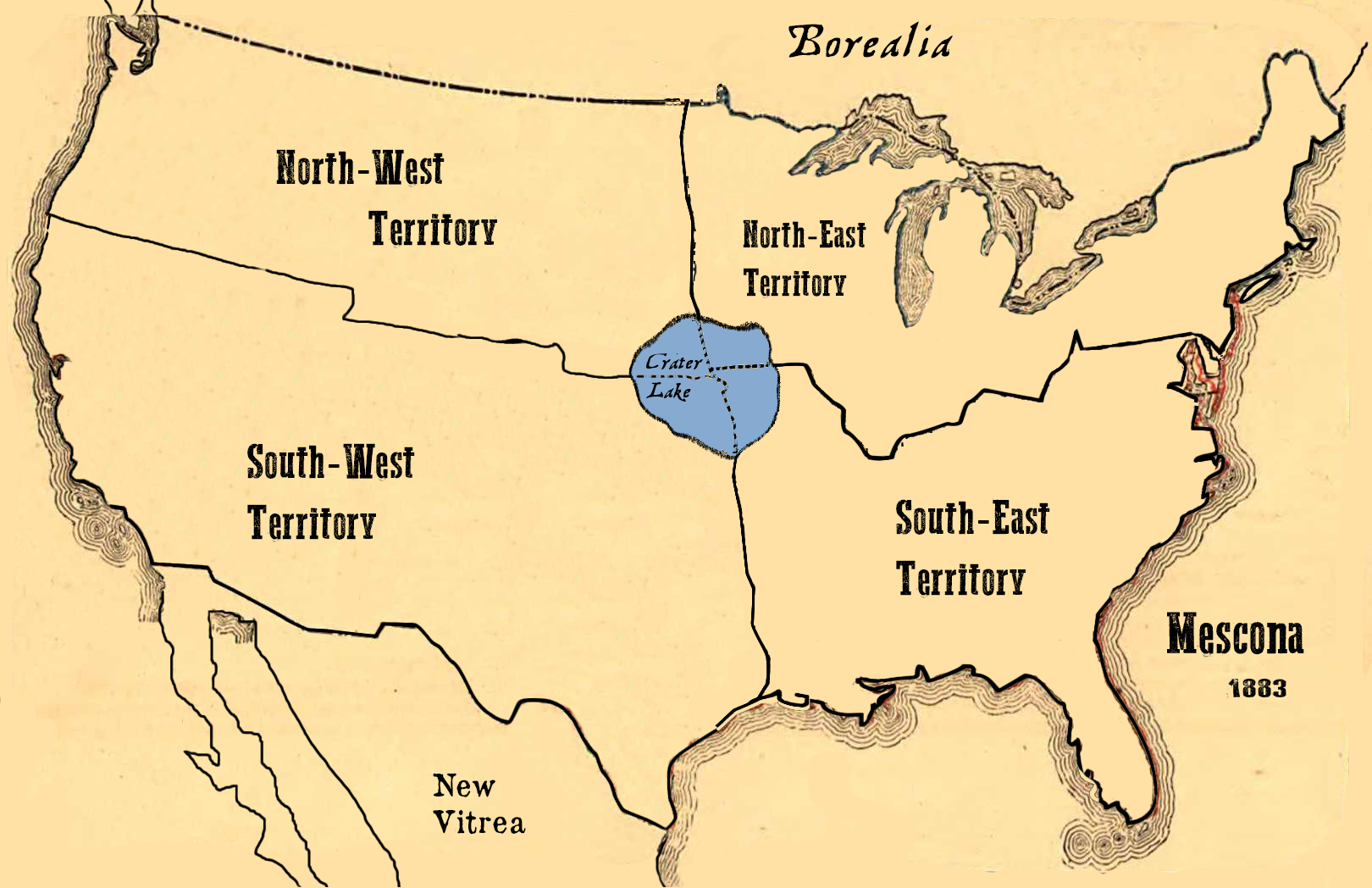
This here's a map I've been working on, modified from a pic of an old map I found online (I don't intend to publish this particular image). I have redrawn the political boundaries as per the setting - in place of America is Mescona, a confederation of self-governed sovereignties which banded together as one unified people out of an early history of foreign oppression. So yes its very similar to America. The key lies in the details, which I'll not weigh down this thread by going into just yet.
Mostly the point of this thread is I'm trying to see if anybody has tips for mapmaking, be they tips of the cartographer's trade, good programs to use (I used GIMP for the following image), tips for the more literary side of things (names, naming conventions, comments on the nature of political boundaries), or whatever anybody feels like contributing. I would much appreciate any advice.
That said, the following map is not finished. I intend to add a few geographic changes such as several sizeable craters from a celestial collision in the planet's past (the event which split off this alternate world from the 'real world' timeline), and a few resulting landscape changes. For instance, what would be California was largely split off into the ocean by a huge crater. The great lakes are largely one as the result of a similar crater. Most likely a few more notable changes. Thoughts and critiques, be they of a visual nature or a literary nature, are quite welcome. I'm curious if anyone else even likes this idea.
Here's the map:

Regards, PS
This here's a map I've been working on, modified from a pic of an old map I found online (I don't intend to publish this particular image). I have redrawn the political boundaries as per the setting - in place of America is Mescona, a confederation of self-governed sovereignties which banded together as one unified people out of an early history of foreign oppression. So yes its very similar to America. The key lies in the details, which I'll not weigh down this thread by going into just yet.
Mostly the point of this thread is I'm trying to see if anybody has tips for mapmaking, be they tips of the cartographer's trade, good programs to use (I used GIMP for the following image), tips for the more literary side of things (names, naming conventions, comments on the nature of political boundaries), or whatever anybody feels like contributing. I would much appreciate any advice.
That said, the following map is not finished. I intend to add a few geographic changes such as several sizeable craters from a celestial collision in the planet's past (the event which split off this alternate world from the 'real world' timeline), and a few resulting landscape changes. For instance, what would be California was largely split off into the ocean by a huge crater. The great lakes are largely one as the result of a similar crater. Most likely a few more notable changes. Thoughts and critiques, be they of a visual nature or a literary nature, are quite welcome. I'm curious if anyone else even likes this idea.
Here's the map:
Regards, PS