Esudeath
 Dreamer


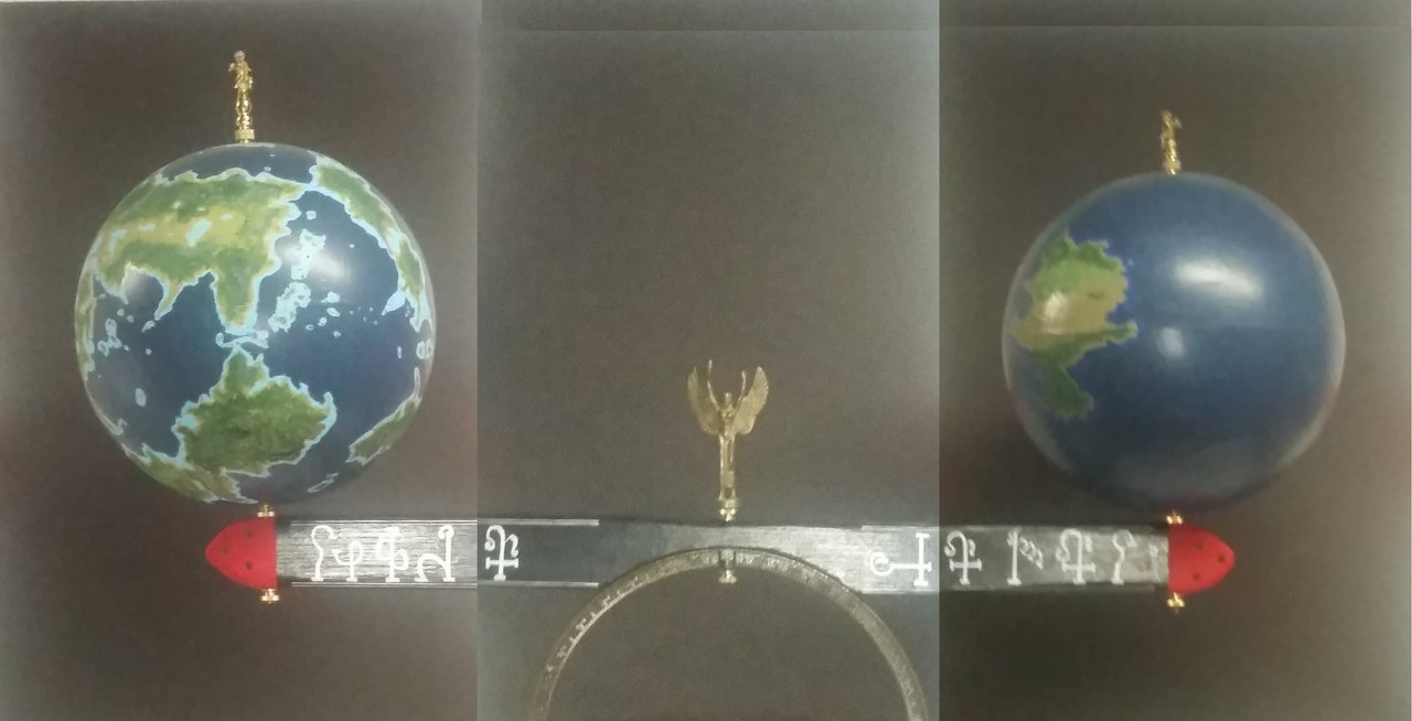
It doesn't have much detail--no rivers, mountains, cities, etc. Is this the *entire* world, or just the story part of it? If the entire, then the two big continents are about the same distance apart east-west (if the map wraps around). Not a criticism, just trying to get perspective. Also, if entire, then the southern parts are near the south pole, the northern parts the north pole. What's that pale gray bit up at the top? I see, or think I see, some lighter green and darker green. Does that signify? If so, you might want to increase the contrast.
You might consider popping over to the Cartographers Guild and see how others have done their maps. Have fun!
Ok...running a thumbnail calculation and assuming the world is a sphere, I get a east/west circumference on the order of about 5000 miles, which works out to a diameter of around 1600 miles (these are rough numbers.) This makes for an extremely small planet, smaller than earths moon...and probably too small to be plausible. I see this in all too many fantasy 'world maps,' that in actuality show only a relatively small portion of the world.
I'd argue this shows merely part of one hemisphere, or about a third of the planet excluding the arctic/antarctic regions. The rest could be mostly ocean perhaps with island archipelagos.
Curvature of the globe is important: the distance of a degree of longitude at +45 is *half* that at the equator. Projected onto a flat surface without correction, this makes for seriously distorted distances, especially at the higher latitudes. With a proper projection, the southern reaches of your first state and the northern portions of your second state would be much smaller than your map allows for.
The area between your first and second states is equatorial, if I understand your scheme correctly. That region will be hot - as will your third nation.
I am unclear what you mean by the references to terrestrial landmasses on the map (Europe, North Africa, and so on). Are these indicators of relative size? Or cultural notations?
That said, the shapes of the landmasses work, though you do need to denote mountains (volcanic or along fault lines), major rivers, forests, and deserts.
Holy hell thank you for that advice?? I had a feeling it was pretty small since I've only recently been thinking about its size. And the references are just cultural so you are right.
How would I make my world look larger? Ive been struggling with that for about a year just getting its general shape.
Keep in mind, if your world map is 25 inches across, it also needs to be 25 inches from top to bottom! (If your planet is (roughly) spherical anyway. A lot of fantasy maps end up being widescreen and won't end up fitting onto a globe.
Not quite. Longitude requires 360 degrees, or 25 inches at 1000 miles to the inch for an earth sized planet. Latitude, though,is pole to pole, 180 degrees, or half that (12 inches). More, the polar regions - north of +70 and south of -70 probably don't need to be included.
