-
Welcome to the Fantasy Writing Forums. Register Now to join us!
You are using an out of date browser. It may not display this or other websites correctly.
You should upgrade or use an alternative browser.
You should upgrade or use an alternative browser.
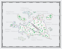
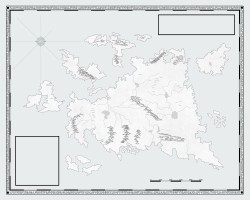
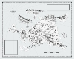
Completed Map of Illia'thar
- Thread starter Miskatonic
- Start date
Gospodin
 Troubadour
You should be please.
 I am envious.


Last edited:
Gryphos
 Auror
Auror
Are those islands on the left supposed to look like the British Isles? Because they do.
Sick map though.
Sick map though.
Commissioned ... from whom?
(I'm shopping maps and map-makers myself)
(I'm shopping maps and map-makers myself)
MineOwnKing
 Maester
That looks perfect.
If it takes up two pages, would you need to make it a fold out so that the spine doesn't hide parts of the map or would you just split the whole map in half and print separately?
If it takes up two pages, would you need to make it a fold out so that the spine doesn't hide parts of the map or would you just split the whole map in half and print separately?
- Thread starter
- #6
Miskatonic
 Auror
Auror
Are those islands on the left supposed to look like the British Isles? Because they do.
Sick map though.
Basically I took Europe from the British Isles all the way east to the Ural Mountains and then messed with the land masses until I had something I liked. There's another continent to the south that is an alternate take on Africa (not shown on the map). Then you have another even bigger continent where all the supernatural/fantasy beings exist on, which is to the east of the one above.
I don't have plans to have those two made, at least not at the moment. They will get done eventually.
Last edited:
- Thread starter
- #7
Miskatonic
 Auror
Auror
- Thread starter
- #8
Miskatonic
 Auror
Auror
- Thread starter
- #9
Miskatonic
 Auror
Auror
That looks perfect.
If it takes up two pages, would you need to make it a fold out so that the spine doesn't hide parts of the map or would you just split the whole map in half and print separately?
I need to get the story written before I worry about that sort of stuff.
But to answer the question if the first story focused on areas on that map exclusively I'd probably like a two page spread with the paperback and then a gated fold out type picture for the hardcover.
The first thing I'm doing however is getting a poster made so I can hang it on my wall.
- Thread starter
- #10
Miskatonic
 Auror
Auror
thedarknessrising
 Sage
Sage
I like that a lot! Fantastic job!
- Thread starter
- #12
Miskatonic
 Auror
Auror
Commissioned ... from whom?
(I'm shopping maps and map-makers myself)
Your inbox is full.
Russ
 Istar
Istar
I will be shopping for a map maker soon myself if you want to try my inbox which is not full 
- Thread starter
- #14
Miskatonic
 Auror
Auror
If anyone has questions about the map itself or the map making process, feel free to ask.
Incanus
 Auror
Auror
Really excellent, Miskatonic.
I'm going to have to get my map in order one of these days. My working version is covered with emendations, corrections, things crossed out, and extra hills and forests penned in on top of the original. I think I've got somewhere between 80 and 100 names on it. All on an 8.5 by 11 piece of paper. It's an eyesore to say the least.
I'm going to have to get my map in order one of these days. My working version is covered with emendations, corrections, things crossed out, and extra hills and forests penned in on top of the original. I think I've got somewhere between 80 and 100 names on it. All on an 8.5 by 11 piece of paper. It's an eyesore to say the least.
FifthView
 Vala
Vala
A very useful map, Miskatonic.
I spent a few full weekends drawing my continent map using mostly Gimp and various brushes to get the mountains and forests and seas looking great. Whole thing looks a lot like a charcoal drawing. I see you included roads, which was something I haven't included on mine. I also don't have national borders–but that's because there aren't any on mine. (There are regional borders, since the empire is subdivided into administrative districts, but I haven't drawn those demarcations either.)
I drew a separate map for one particular small island which will figure heavily into the story.
I'm very, very happy with my maps but I have a serious problem. I need to do detailed maps of at least the capital city, since a lot takes place there, and perhaps maps of some large towns on that island. My geographical continental map is pretty good, I think, but drawing down into the cities/towns seems a lot more complicated to me. Part of my problem is simply that I haven't given enough thought to the many details of the capital city or even the towns on the island. I don't need a map of those, but for whatever reason I'm a little irritated not having them. (And I'm already planning to use this world for multiple stories, so...)
- Thread starter
- #17
Miskatonic
 Auror
Auror
- Thread starter
- #18
Miskatonic
 Auror
Auror
A very useful map, Miskatonic.
I spent a few full weekends drawing my continent map using mostly Gimp and various brushes to get the mountains and forests and seas looking great. Whole thing looks a lot like a charcoal drawing. I see you included roads, which was something I haven't included on mine. I also don't have national borders–but that's because there aren't any on mine. (There are regional borders, since the empire is subdivided into administrative districts, but I haven't drawn those demarcations either.)
I drew a separate map for one particular small island which will figure heavily into the story.
I'm very, very happy with my maps but I have a serious problem. I need to do detailed maps of at least the capital city, since a lot takes place there, and perhaps maps of some large towns on that island. My geographical continental map is pretty good, I think, but drawing down into the cities/towns seems a lot more complicated to me. Part of my problem is simply that I haven't given enough thought to the many details of the capital city or even the towns on the island. I don't need a map of those, but for whatever reason I'm a little irritated not having them. (And I'm already planning to use this world for multiple stories, so...)
I haven't even begun to think about city maps yet. I'd love to have one of Veldencrest and Nalencia since those are two cities that are focused on the most when it comes to every day life. I still have a lot more research to do to get an idea of the type of layout I want that corresponds with what medieval cities would look like.
I needed political boundaries since the continent is divided up among individual kingdoms with their own principalities controlled by feudal lords. Roads were helpful because I can get some rough calculations on travel times between villages and what not. I wasn't familiar at all with how bodies of water and mountain ranges actually look when done realistically; so I had to adjust initial ideas to fit around how those were laid out.
indonesiancat
 Dreamer
If anyone has questions about the map itself or the map making process, feel free to ask.
Voldenskagg and Nytt Voldenskagg I would assume is Scandinavian influenced. I reckon you're planning to put fantasy vikings there?
- Thread starter
- #20
Miskatonic
 Auror
Auror
Voldenskagg and Nytt Voldenskagg I would assume is Scandinavian influenced. I reckon you're planning to put fantasy vikings there?
I'll mix things up a bit but it will certainly have a viking/Norse influence.
The names of the different kingdoms all try and have a similar ring to them. Zostrova obviously having more of an eastern European sound for its cities. Sanguinestos's cities are either Romanian or Hungarian words.
I want to use medieval European cultures as the base and then change various things so they have their own unique features.
The first half of the story is far more focused on realism.
I'm trying to narrow down a time frame to use as a reference for how every day life is, what architecture is like, etc. Hovering around rougly the mid 13th to mid 14th century.
Similar threads
- Replies
- 66
- Views
- 8K


