• Welcome to the Fantasy Writing Forums. Register Now to join us!

My currently un-named world and its map

For my worldbuilding I'll be using a map from Azgaar as a base and building everything inside it. This is because I'm not a mapmaker and also I liked the challenge of working withing a premade map.


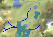
It's dominated by grasslands, shown in tan. The lighter yellow is hot desert and the brown next to it is cold desert. The greens are various forests and the white is ice. I wanted to explore a desert culture so I liked the amount of desert in this map.

But what does everyone else think? Is this map a good starting point or does it have flaws I'm not seeing?
 

pmmg

Myth Weaver
Who can really say a map has flaws? I'd say it has more land than water, which is different than Earth, but... Actually looks kind of similar to my map...

I think it suits if you want to fit some peoples and stories in it.

What is being used for Mountains?
 

Sheilawisz

Queen of Titania
Moderator
Hello OutsidersEyes!

We have approved your Map images here so far, but since they work as links to get the App in question, I'll have to ask you to please share your maps as normal images.

For example, take a screenshot of the Map and upload it to the Gallery here in Mythic Scribes.

Otherwise, the links would have to be treated as Spam.

Thanks!
I don't have permission to add media, the pop up says. I assume this is just because my account is new.
 

Sheilawisz

Queen of Titania
Moderator
Just keep posting, and very soon the system will allow you to upload files to the Mythic Scribes Gallery.

Also, you can upload your maps to a different image hosting site, that works as well to get them posted here, without the App download links.

I am sorry to bug you with this, it's just a bit of site rules that we have to be careful with.

Thank you!
Oh no problem, I get it that links can be untrustworthy. I think I can post to the gallery now, thanks.
 

pmmg

Myth Weaver
You need five posts to become fully functional on scribes.

Anyway...now I get to pick on it a little ;) I asked about the mountain because of two features. One: rivers tend to flow from mountains to the ocean. So when you have a large lake next to the mountain, that would indicated the lower ground. So...this map shows waters starting out on the plain and flowing towards the mountain to make the great lake near it. and Two: Mountains tend to cause the land on one side to become arid and the other more forested. Just the way air and water behaves moving over them. Which is only to say, while not impossible, some features are unlikely.

All things considered though, I wish I had such a map when I started many years ago.
 

ThinkerX

Myth Weaver
Made maps with MS Paint. Included Latitude and Longitude lines, the later set at angles to allow for longitude distortion, done in 40 degree east-west increments.
 
You need five posts to become fully functional on scribes.

Anyway...now I get to pick on it a little ;) I asked about the mountain because of two features. One: rivers tend to flow from mountains to the ocean. So when you have a large lake next to the mountain, that would indicated the lower ground. So...this map shows waters starting out on the plain and flowing towards the mountain to make the great lake near it. and Two: Mountains tend to cause the land on one side to become arid and the other more forested. Just the way air and water behaves moving over them. Which is only to say, while not impossible, some features are unlikely.

All things considered though, I wish I had such a map when I started many years ago.
That's a really good point about the mountains. I can't see the water flowing towards the mountain but I know I'm just overlooking it. And about that desert town, it would obviously be on the east side of the mountains with the west getting the majority of the rainfall. Maybe near those two lakes, or maybe the lakes should go. Or perhaps that whole area is just arid and the desert can also exist to the west of the mountains? This is why I definitely wanted to talk with people who know more about this than I do.
 

pmmg

Myth Weaver
Ah...see my media made it to the big screen...anyway...

full


Area 1 is on raised ground. A lake could not form there.

Area 2 is the start of a river, but there is no raised ground around it.

Area 3 would seem to be low ground that might feed area 2, but since its lower, its just a lake. Something has to feed it. Water from the mountain is most likely.

full


A river system should feed the lake, and if it overflows, it might make a river heading north to feed the little lake above. Here the mountains left and right are sending water down hill to the lake.
Thank you! That does seem to make more sense now that I see it clearly. I'll add that and consider what to do with the mountains when I have time later today.
 
Okay, good. Is this the equatorial region, a hemisphere? If it were Earth, more or less where would you place this region and what extent would it have?
I'd like to leave it as Azgaar left it, which is to say that the center is the equator. As to the size, viewing it as a globe the left and edges are right on the edges of the visible part of the globe, aka not halfway around perfectly. Roughly twice the width of Africa at its widest point.
 

TheKillerBs

Maester
I'd like to leave it as Azgaar left it, which is to say that the center is the equator. As to the size, viewing it as a globe the left and edges are right on the edges of the visible part of the globe, aka not halfway around perfectly. Roughly twice the width of Africa at its widest point.
What about the distance from top to bottom? Is this an equirectangular projection? Does your software tell you this?
 

pmmg

Myth Weaver
I find it hard to name my world. One because I dont know a good thing to call it, but two becuase I think different cultures would call it different things. They may not even think of it in world terms, more like our land and your land kind of thing. In my head, I have just been calling it the silver world, but really that would not be its name. Maybe some day it will come to me.
 

Demesnedenoir

Myth Weaver
My first thought heads toward climate with that amount of land mass. I've probably forgotten more than I know about such things since I haven't dealt with it for years, but my immediate impression is there would be a lot of brown for deserts.
 
Top