Shockley
 Maester
Thank you. I appreciate the comments.


Would anyone be interested in Tutorial about using GIMP to create maps? I would only cover the things I have done in my map, like how I made the mountains and everything else. But the only problem is I don't know How much time I would have to devote to this, I still have classes and all that but if enough people are interested I may give it some thought and put some time aside.


Another Campaign Cartographer fantasy map. This program can be really fun to use.
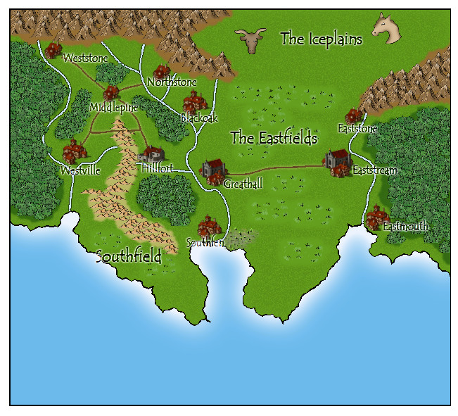
The Coppermane Alliance, so named for its population of red-haired white people, is a confederation of democratically run city-states linked by a central council in Greathall. The Coppermanes are generally peaceful, but they are fiercely patriotic and will fight to the death to defend their Alliance.
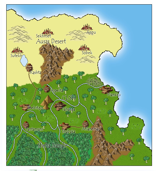
The Coppermanes' culture is roughly based on Anglo-Saxons and other Germanic peoples of northern Europe. This gave me the fun opportunity to use descriptive English names for the towns and geographic regions. If you want to know the Coppermane area's geographic context, it's north of the Heladoan Archipelago, which in turn is north of Cush.
That's pretty cool Jabrosky. I like your CC maps. Is the program user-friendly at all? I was thinking about getting CC, but I was put off by the Fractal Terrains 3 demo from the same company because it seemed so difficult to use. Is Campaign Cartographer easier to use than FT3? And does it allow you to easily reproduce hand drawn maps or trace over existing pictures?
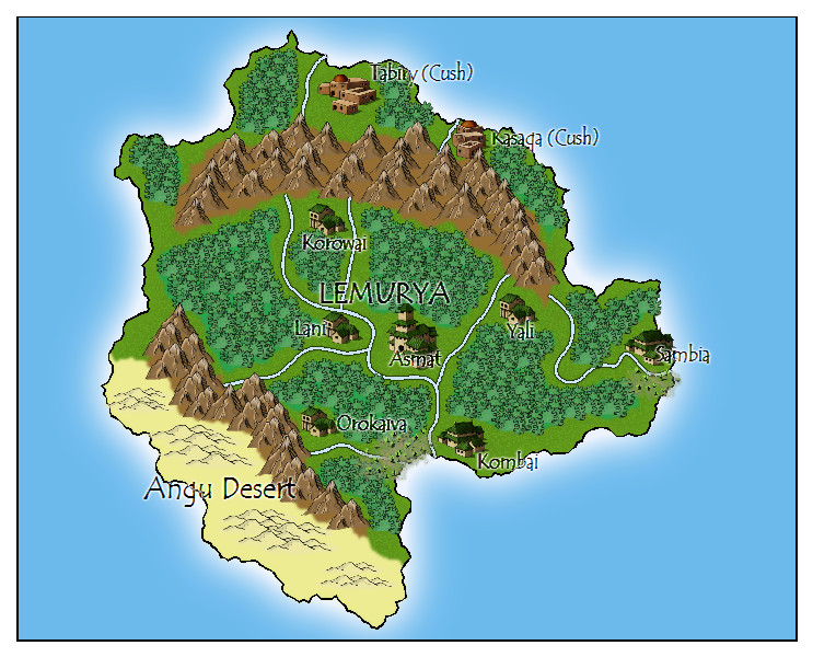
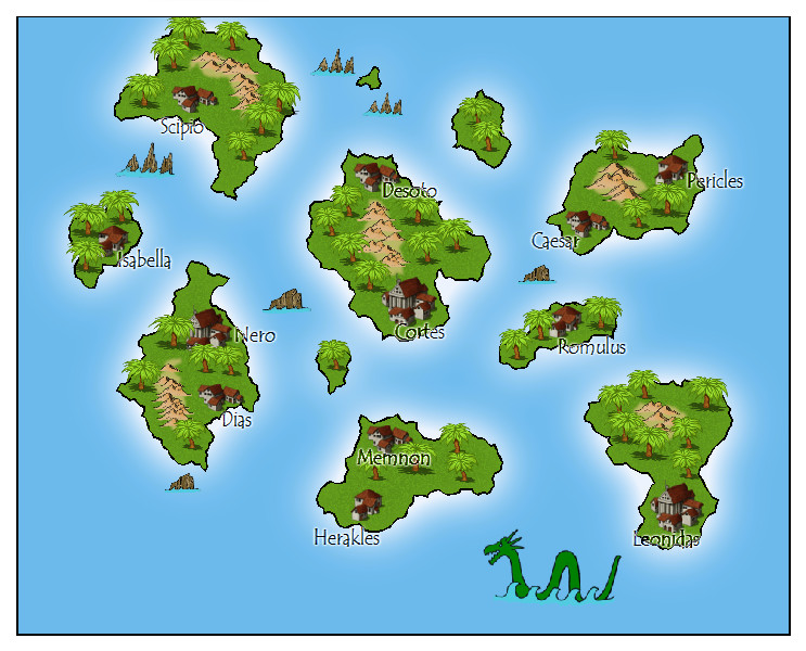
Also, are you ever going to put all these places on one map so we can see where they are in relation to each other?

@Jab, Mountains are tough. >.< On the one hand, I don't want them to be white-capped and really strange looking against the gradient, but on the other hand, they do kind of just look like hills right now. I'll work on it.
@Mindfire, I use Photoshop. The landmasses are generated randomly, at first, using 'clouds', but I tweak them to look more like the continents and islands I wanted. The mountains and sea depths are created with more clouds, just used as a texture and edited out when appropriate (I removed the mountains from the desert, for instance). The colour is just a gradient over the whole thing, from a dark green to a pale green to a sand colour. The rest is just tweaking with the layer styles - emboss, glow, that sort of thing. Aside from choosing colours and having a steady hand while touching things up, it required no real artistic talent.
