Lawfire
 Sage
Sage
Very crisp and clean! I like it.
Very crisp and clean! I like it.


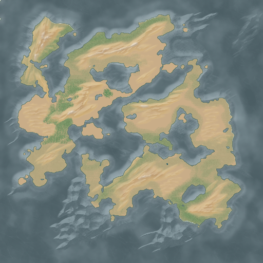
I've been studying this tutorial from the Cartographers Guild for a couple days now, and today I finally got the chance to try it out (it required downloading some plugins for GIMP before I could mimic some of the functions this guy uses).
The tutorial taught me a ton. I made some mistakes going through it, and ended up with a map that has much less detail and where the underwater and on-land detail doesn't seem to match up (the underwater stuff I followed much more closely, and it ended up pretty good). I learned a lot once I decided to just depart from the tutorial and finish it up in a different way, but I'm not likely to try and make this look any better.
It was a valuable learning experience. The map style portrayed in this tutorial is damn near perfect to my eyes, and I'm really looking to master it. For a first attempt, this wasn't bad. If I were to change the coastline to match, it might almost be its own style.
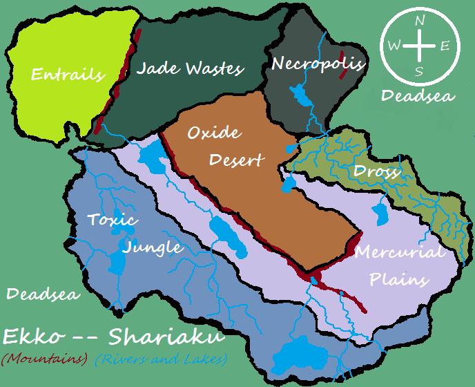
...Entrails?
I have worked so hard on this tutorial, yet I couldn't do anything!!! Spending many hours for nothing made me so nervous that I have never tried again.
Where did you find those plug-ins, I wonder? Maybe I will try once again if I can use them.
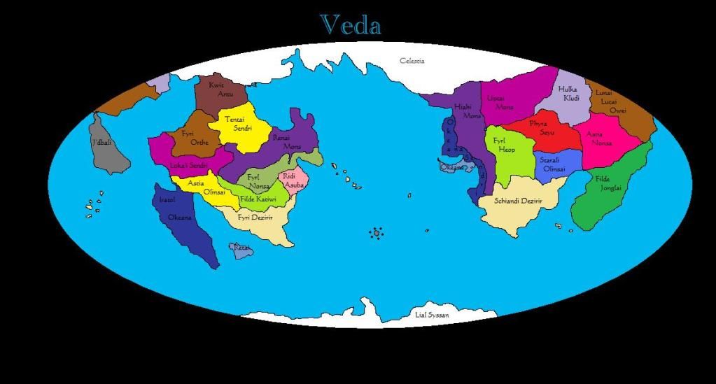
Awesome map PrincessaMiranda! I thought of going elliptical but decided in the end to go for the deformed rectangular version that cannot accurately cover a globe.
 looks like I stepped on it. but it only took ten minutes to make.
 I may have squashed it a little too much.
Mine took 3 months -_-
Although I have a 4 foot by 4 foot pencil drawn version as a souvenir! That counts for something, right? Oh, it doesn't? Shucks.
wish i could do maps, dont have time or my darwing tablet; even though i cannot draw if my life depended on it maybe once i get some time i might get something on to here 