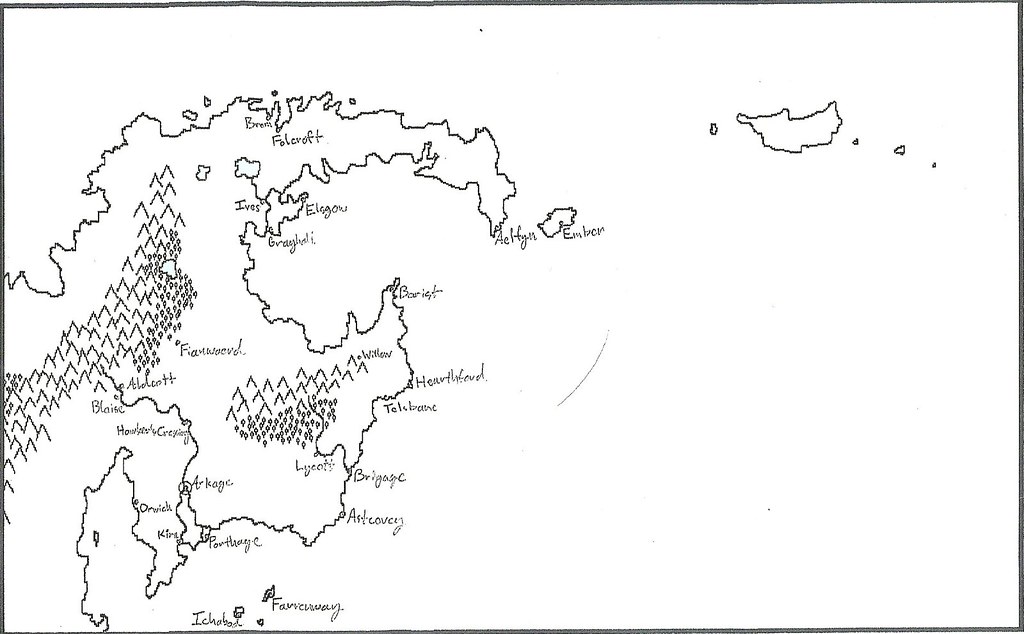
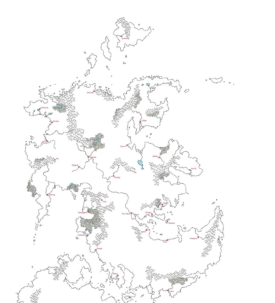
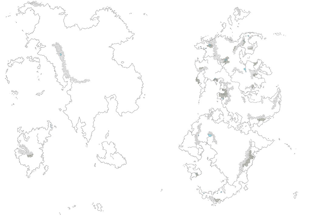
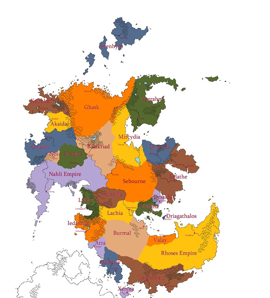
• Welcome to the Fantasy Writing Forums. Register Now to join us!

Anybody care to share their map?

Johnny Cosmo

Inkling
I look forward to it. I'm still trying to pluck up the courage to show mine (although I'm thinking of redesigning it anyway).
 

Elishimar

Dreamer
Alright, here is the link to my photobucket with my map. I apologize, it may be a little hard to see as it is a pencil drawing. I can't find where I put my pen rendering of it, so I will make a new one this weekend, and share that as well. By the way this is only one region of my map, i will have to find my world map as well. Either way it is a good example of how I am dealing with map making, and I hope it helps.


ascanius

Inkling
Don't know if anyone has posted this but i found a great program that is free for making maps. It's called Autorealm, it was designed for role-playing but I found it works great especially since you can use fractal lines to create coasts and shorelines along with custom icons. It's only draw back that I could find is that it has a learning curve to fully utilize all it's features. And you have to make closed lines to color entire areas or the whole screen will change that color. Also a nice feature is it can calculate the distances between two points in many different units.
 

Fiain

Dreamer
Hey all! I'm new to this thread, so I apologize if I do something wrong haha but here are a few maps I've created for a world I'm working on. These are just the bare bones; I'm working on a climate map and culture map, so hopefully I can post that sometime haha. I would love to hear what you all think of them.


[/IMG]
 

Johnny Cosmo

Inkling
My only thought is that you could have linked to the images, since they break the post boundaries (but not by much, so it's not too bad).

As for your maps, they look good, and I look forward to seeing something more complete when you get around to it! I like the continent shapes, nice job. So how big are these continents?
 

Fiain

Dreamer
The middle continent is about the size of North America. And thank you the feedback! These are my first maps, so I'm still kind of learning haha
 

ascanius

Inkling
Hey Fiain what program did you use? I'm using autorealms simply because I can use layers for Political, settlement, terrain and notes to go from detailed to less detailed, and I haven't found anything else that is free. I tried using gimp but haven't been able to make any headway with it. Also did you design the maps based off your story or did you base your story off your map. I had an idea of what how I wanted my map to look and designed it more around the story to fit some specific events and scenarios, though I am finding some problems with this. Another question how did you go about determining forest and river density? I take it the rivers shown are only main rivers. What about distances did you figure those into your map as you created it? I like it a lot. It looks clean and simple, good job.
 

Fiain

Dreamer
Hey Fiain what program did you use? I'm using autorealms simply because I can use layers for Political, settlement, terrain and notes to go from detailed to less detailed, and I haven't found anything else that is free. I tried using gimp but haven't been able to make any headway with it. Also did you design the maps based off your story or did you base your story off your map. I had an idea of what how I wanted my map to look and designed it more around the story to fit some specific events and scenarios, though I am finding some problems with this. Another question how did you go about determining forest and river density? I take it the rivers shown are only main rivers. What about distances did you figure those into your map as you created it? I like it a lot. It looks clean and simple, good job.

Hahaha I just used paint and went pixel by pixel lol I feel that it lets me get a good, hand-drawn feel out of my maps but is still easier to edit and add things to than a real hand drawn one. It takes a while haha but I think it is worth it. And the story of mine is probably blended in with the map; as in, I know what kind of country (climate, culture, etc) I want it to start in, and thus made sure my map had an area like that. And yes, only the main rivers are shown, as are only the most heavily wooded areas. I simply took what seemed realistic and combined it with what looked good haha. Distances was something that I didn't bother with at all; I wanted to creat the map, put things where I want them, then worry about distances later. Hope that explained things a lilttle bit haha I have never used autorealms.
 

Johnny Cosmo

Inkling
You did all that in paint, pixel by pixel? That must've taken quite some time! It's certainly given your continent borders a nice look.
 

ascanius

Inkling
I tip my hat to you Fiain, indeed I do. You did a good job with the map, and display a deal more patience than I would ever care to exhibit. Sorry I cant help you Elder the Dwarf, I'm a windows user. I found Autorealms on chance doing a search for fantasy map making software. You might want to try that.
 

Johnny Cosmo

Inkling
I haven't seen any decent software for Mac I'm afraid. Instead, I've been hand-drawing, scanning, and importing them into a graphics editor (Photoshop, or GIMP if you want a free alternative). The learning curve is probably steeper, but learn to use a graphics editor and you can do anything cartography software can do, and more.
 

Fiain

Dreamer
I tip my hat to you Fiain, indeed I do. You did a good job with the map, and display a deal more patience than I would ever care to exhibit. Sorry I cant help you Elder the Dwarf, I'm a windows user. I found Autorealms on chance doing a search for fantasy map making software. You might want to try that.

Haha well thank you very much! To be honest, I just blare some trance tunes and get in the groove, and time kinda just zooms by haha just remember that if you DO make a map in paint, to save it as a .png, or else you'll get these nasty blurry gray lines around everything that you draw. I had to learn the hard way, and spent nearly two weeks going along every single line eraseing all the extra marks hahaha

EDIT: Also, can someone help me figure out the best way to upload pics? I'm trying to figure it out, but they keep breaking the boundaries. Anyway, here is a political map that I've made in Paint.

 
Last edited:

Johnny Cosmo

Inkling
@Fiain: You're map is looking very nice, though the red text gets a bit lost in places (perhaps you could use a bolder font, and a lighter shade). As for image sizes, it might be best to create a PhotoBucket.com account (or another photo hosting website), upload them there, and then link to the image.
 

Fiain

Dreamer
Thank you! I've been useing Flickr, and it just doesn't work haha. And yea, as for font size, I was worried it was going to be TOO big, but it could probably be a bit bolder. And maybe not red. haha thanks for the feedback :)
 
Top